
: failed to open stream: Invalid argument in <b>/home/servuzmq/minisites/siteT1/common/template/carteV2.php</b> on line <b>139</b><br />
)
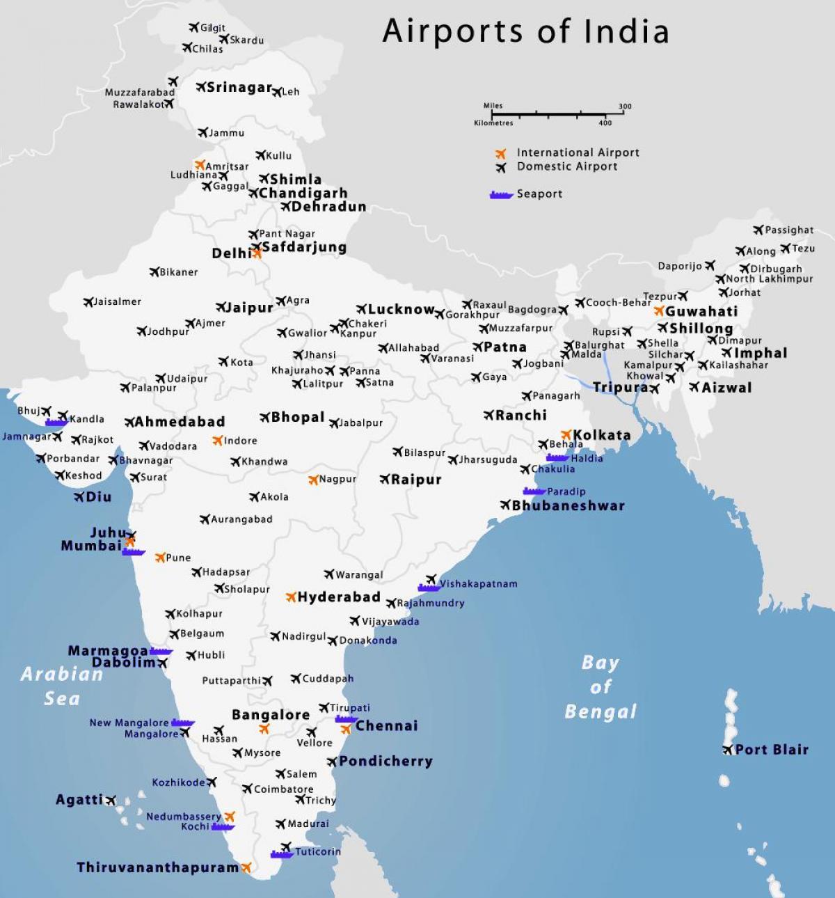
You can find on this page the India airports map to print and to download in PDF. The map of India airport presents details of location and international airports of India in Asia.
The India airports map shows location of airports in India. This airports map of India will allow you to determine which airport you will used to leave or arrive in India in Asia. The India international airports map is downloadable in PDF, printable and free.
There are more than 352 (2010 est.) civilian airports in India - 250 with paved runways and 96 with unpaved runways and more than 20 international airports in the Republic of India as its mentioned in the map of India airports. The Indira Gandhi International Airport and the Chhatrapati Shivaji International Airport handle more than half of the air traffic in South Asia.
India has emerged as one of the most sought after destinations for international travellers. Being one of the largest countries in the world, air connectivity is essential towards aiding the massive tourism industry in the country. The many international airports in India which are functional today, connect the various major urban centres to important urban destinations across most of the continents (see the map of India airports). Alongside the many Indian carriers, many international airlines regularly fly to and from the various international airports found across India.
Airports Authority of India (AAI) manages a total of 125 Airports, which includes 81 Domestic Airports, 11 International Airports, 25 Civil Enclaves at Defence Airfields and 08 Customs Airports as you can see in the map of India airports. AAI is responsible for creating, maintaining, upgrading, and managing civil aviation infrastructure in India and works under the Ministry of Civil Aviation. Know more about the Airport Authority of India in the given link.