
: failed to open stream: Invalid argument in <b>/home/servuzmq/minisites/siteT1/common/template/carteV2.php</b> on line <b>139</b><br />
)
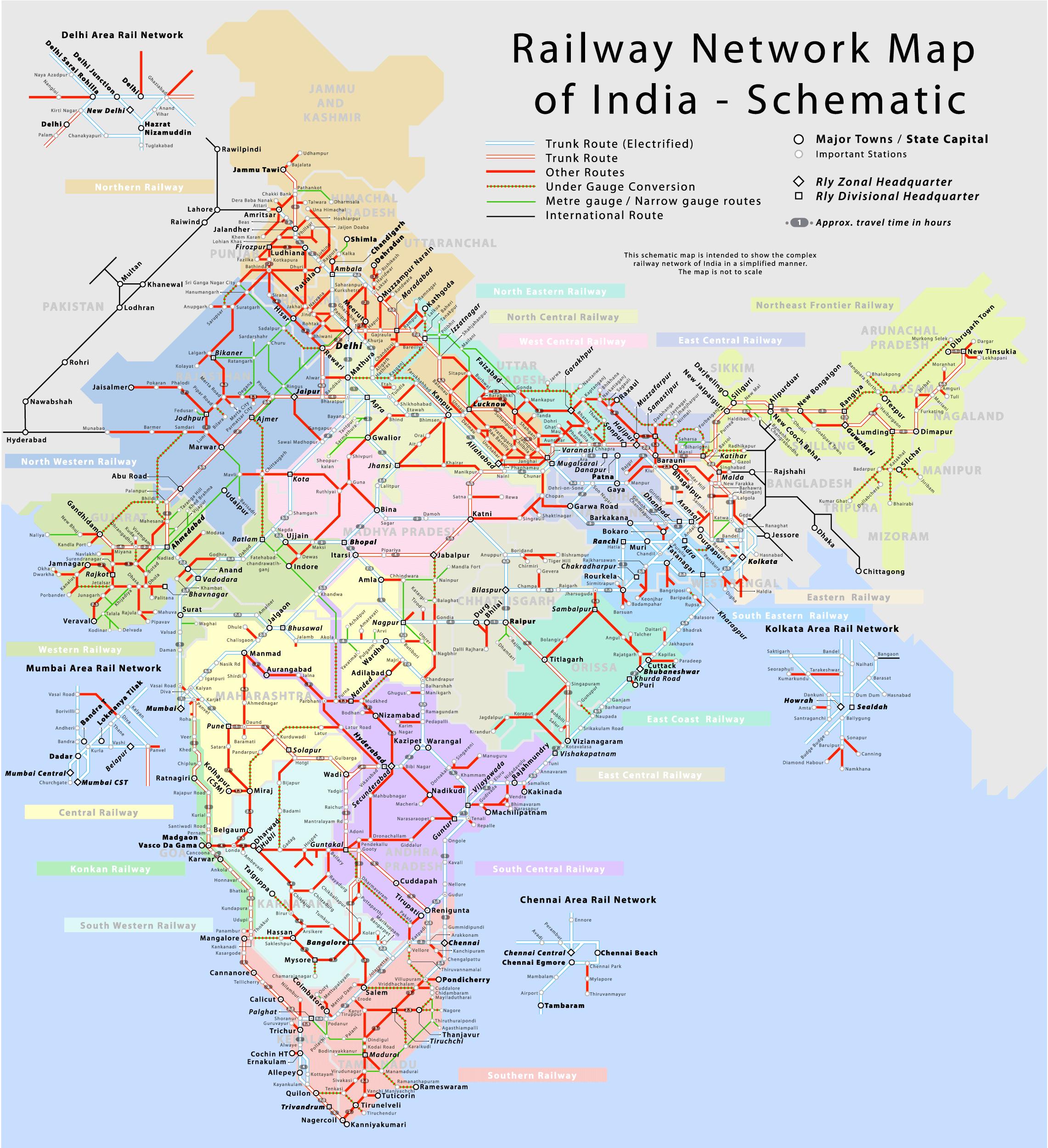
You can find on this page the India trains map to print and to download in PDF. The India railways map presents the rail network and shows high speed rails routes of India in Asia.
The India rail map shows all the railway stations and lines of India trains. This train map of India will allow you to easily travel by train in showing the major rail routes and high speed rail routes of India in Asia. The India rail map is downloadable in PDF, printable and free.
Rail transport is a commonly used mode of long-distance transportation in India. Almost all rail operations in India are handled by a state-owned organisation, Indian Railways, Ministry of Railways. The rail network traverses the length and breadth of the country, covering a total length of 64,015 kilometres (39,777 mi) as its mentioned in India rail map. It is the 4th largest railway network in the world, transporting over 10 billion passengers and over 1050 million tonnes of freight annually.
India rail operations cover twenty eight states and three union territories and also provide limited service to Nepal, Bangladesh and Pakistan as you can see in India rail map. Both passenger and freight traffic has seen steady growth, and as per the 2009 budget presented by the Railway Minister, the Indian Railways carried over 7 billion passengers in 2009. Railways were introduced to India in 1853 from Bombay to Thane, and by the time of India independence in 1947 they had grown to forty-two rail systems. In 1951 the systems were nationalised as one unit—Indian Railways—to form one of the largest networks in the world.
India has rail links with Pakistan, Nepal and Bangladesh. It also plans to install a rail system in southern Bhutan. A move to link the railways of India and Sri Lanka never materialised. Before the Partition of India there were eight rail links between what are now India and Pakistan. However, currently there are only two actively maintained rail links between the two countries. A rail link between Akhaura in Bangladesh and Agartala in India was approved by the Government of India in September 2011. The 15km rail line as its shown in India rail map will cost INR252 crore and is expected to be completed by 2014.