
: failed to open stream: Invalid argument in <b>/home/servuzmq/minisites/siteT1/common/template/carteV2.php</b> on line <b>139</b><br />
)
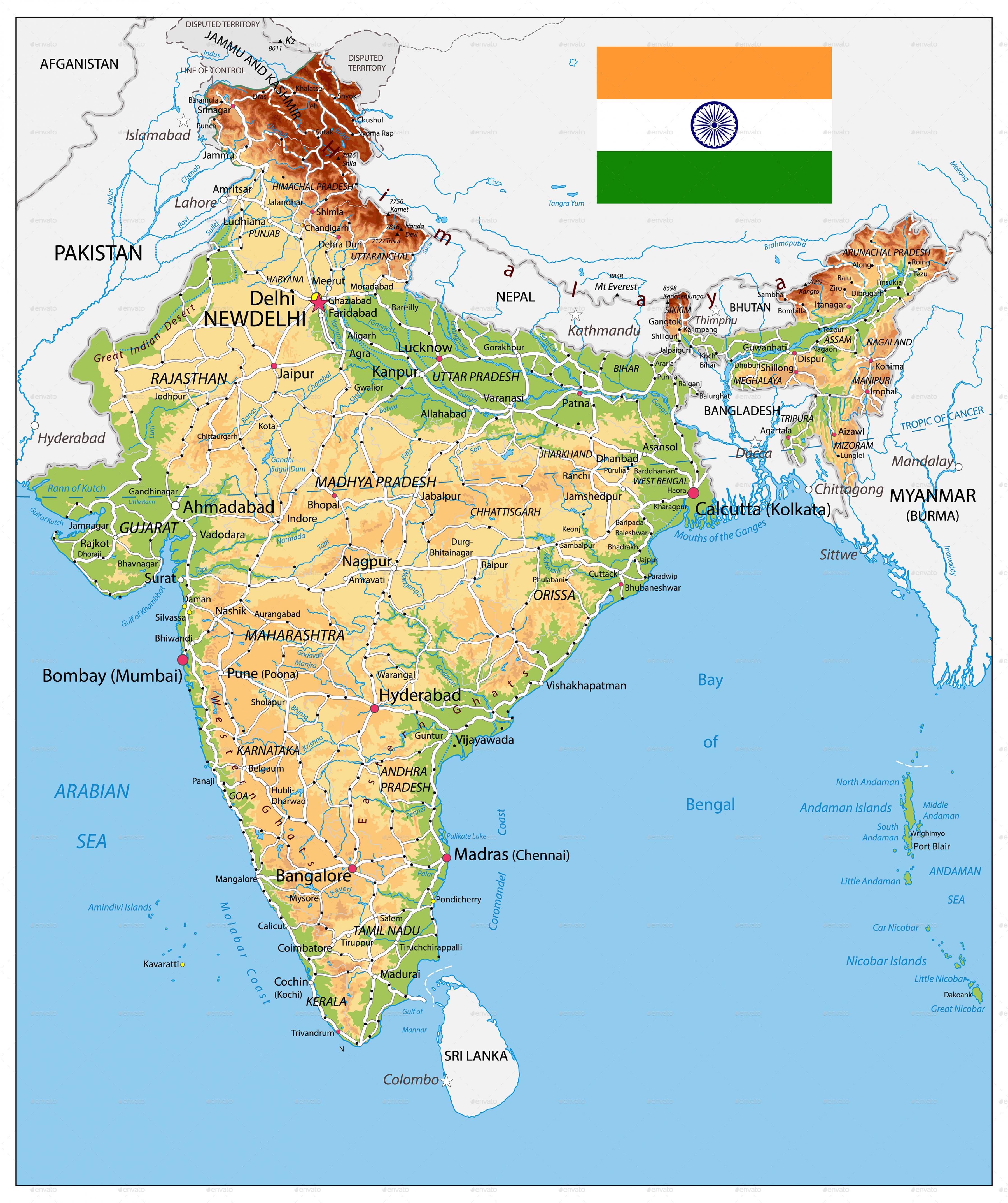
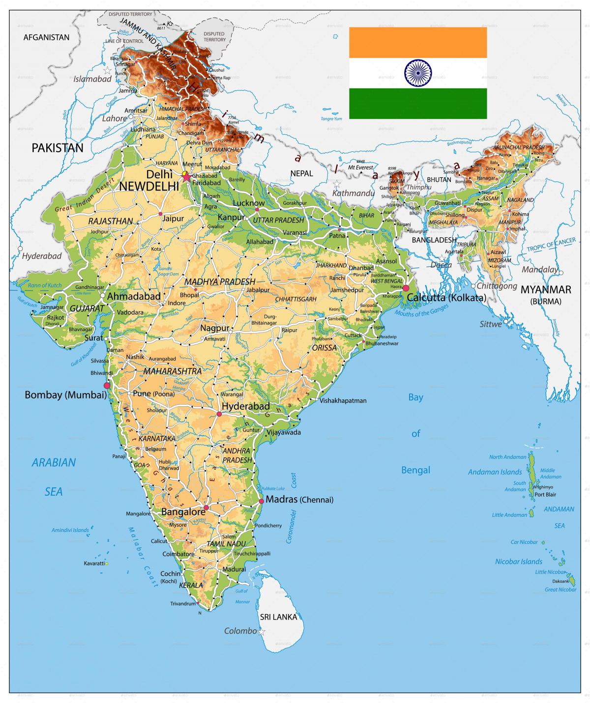
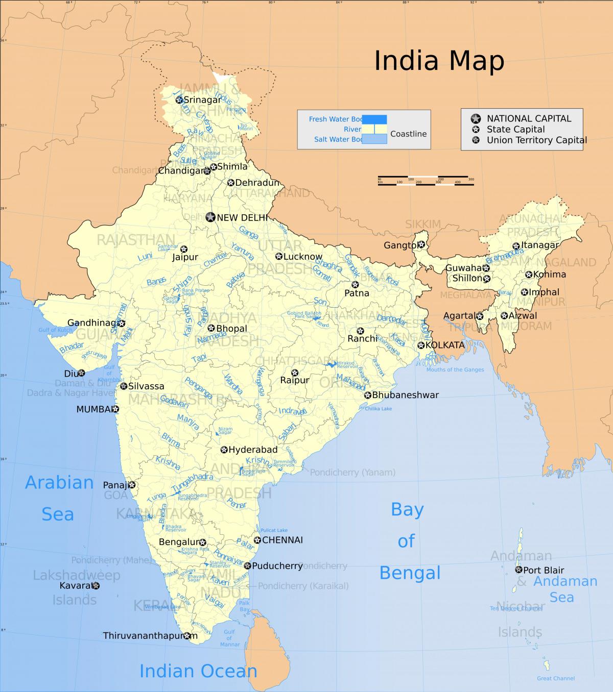
You can find on this page the India geographical map to print and to download in PDF. The India geographic map presents the topography, elevation, rivers, mountains, climate and physical features of India in Asia.
The India physical map shows landform and geography of India. This geographical map of India will allow you to discover physical features of India in Asia. The India physical map is downloadable in PDF, printable and free.
India lies largely on the Indian Plate, the northern portion of the Indo-Australian Plate, whose continental crust forms the Indian subcontinent Physical divisions, are marked by natural configuration. India is divided into six physiographic divisions on basis of the varied physiographic features as its mentioned in India physical map: units as follows: Northern and North-eastern Mountain; Northern Plain; Peninsular Plateau; Indian Desert; Coastal Plains; and Islands.
The wide range of physical features of India makes the country a complete geographical study. In fact, India has every possible landscape that the earth has. From cold mountains to arid deserts, vast plains, hot and humid plateau and wide sea shores and tropical islands as you can see in India physical map, the physical features of India cover every terrain.
Some important physical features of India include as you can see in India physical map: The Himalayas are made up by a chain of very high mountain ranges that run from the northern, northeastern, and western parts of India. The northern Indian plains are made up of an extremely vast stretch of plains, alluvial terrain. The states of Gujarat and Rajasthan govern over the Thar desert – a huge desert featuring dry climate and sandy terrain. The Peninsular Plateau (Includes the Deccan Plateau and the Central Highlands). The western coastal plains of India lie in between the Arabian ocean and the Western Ghats whereas the eastern coastal plains lie in between the Bay of Bengal and the Eastern Ghats. The two primary islands that fall under Indian territory include the Andaman and Nicobar Islands and the Lakshadweep Islands.
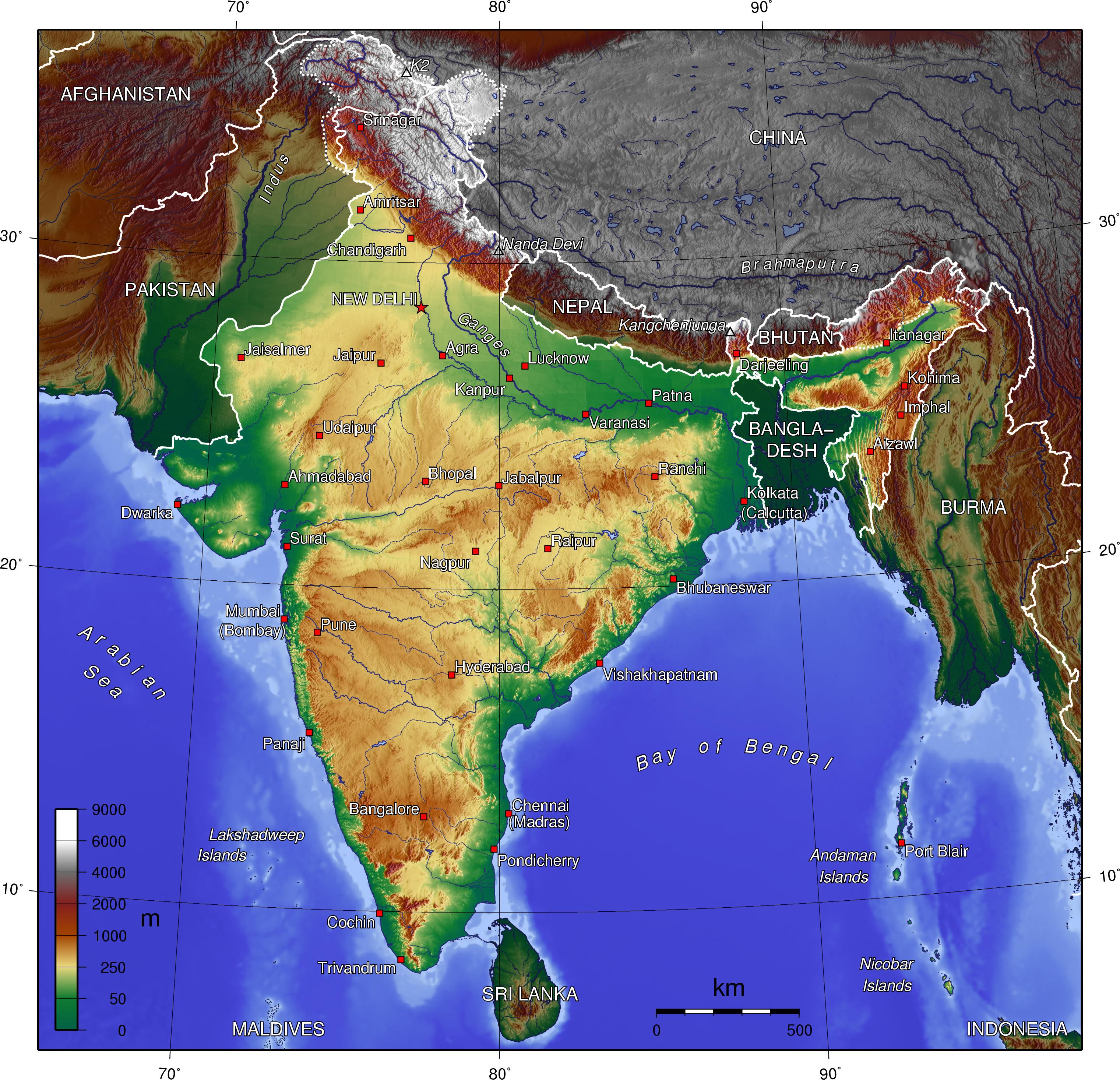
India topographic map shows the physical features of India. This topographical map of India will allow you to discover landforms and geographical of India in Asia. The India topographic map is downloadable in PDF, printable and free.
India is endowed with almost all the important topographical features, such as high mountains, extensive plateaus, and wide plains traversed by mighty rivers as its shown in India topographic map. The country is bounded by Himalayas in the North and has a large peninsular region tapering towards the Indian Ocean. The plateaus are another striking feature of topography in India and they range in elevation from 300 to 900 m.
Three major features fill the Indian landscape as its mentioned in India topographic map: the Himalayas and associated ranges, a geologically young mountain belt, folded, faulted, and uplifted, that marks the nation northern boundary and effectively seals India climatically from other Asian countries; the Peninsula, a huge stable massif of ancient crystalline rock, severely weathered and eroded; and the Ganges-Brahmaputra Lowland, a structural trough between the two rivers, now an alluvial plain carrying some of India major rivers from the Peninsula and the Himalayas to the sea. These three features, plus a narrow coastal plain along the Arabian Sea and a wider one along the Bay of Bengal, effectively establish five major physical-economic zones in India.
The Indian Desert is located to the north-west of the Aravali hills lies the Great Indian Desert as you can see in India topographic map. It is a land of undulating topography dotted with longitudinal dunes and barchans. This region receives low rainfall below 150 mm per year; hence, it has an arid climate with low vegetation cover. It is because of these characteristic features that this is also known as Marusthali.
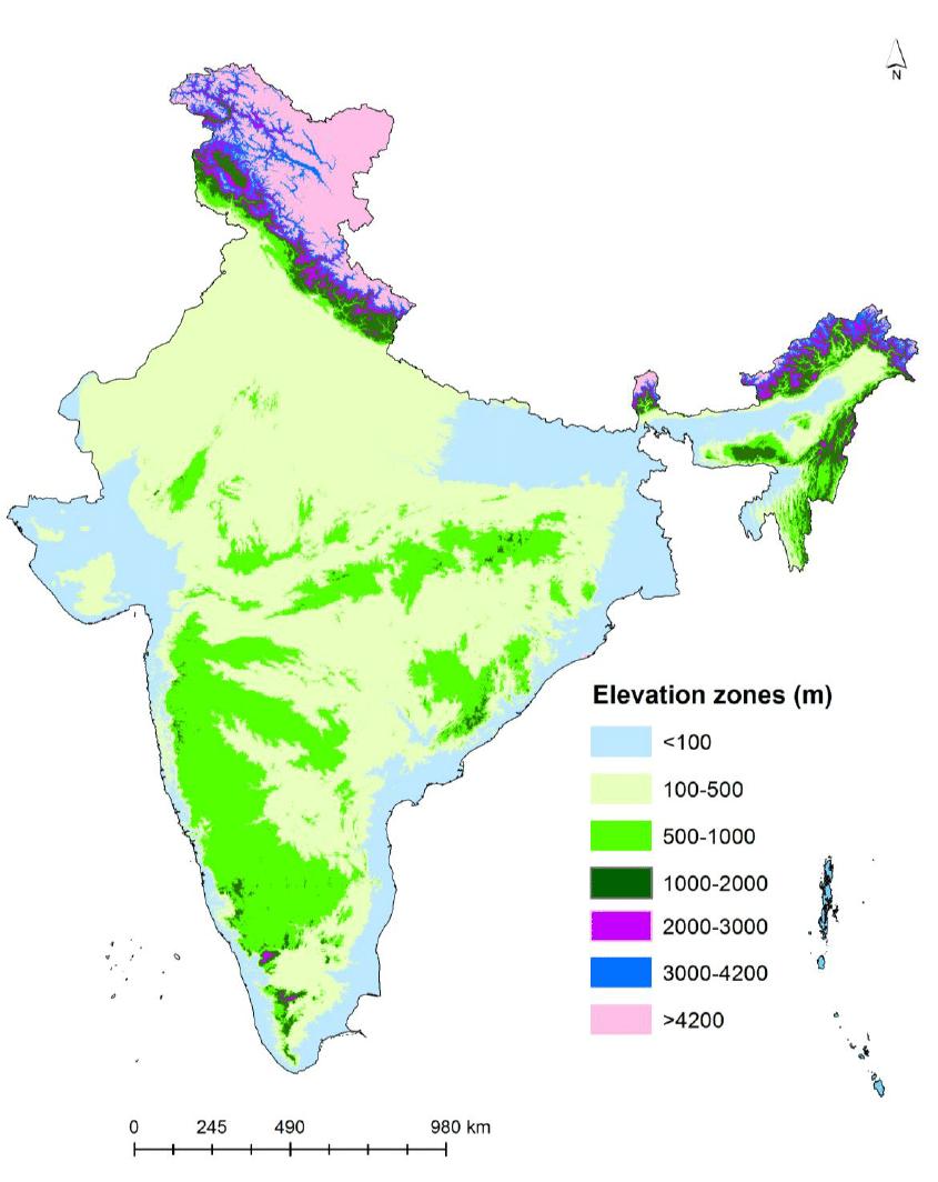
The India elevation map shows the different altitudes of India. This altitude map of India will allow you to know where are the highest and lowest regions of India in Asia. The India elevation map is downloadable in PDF, printable and free.
The region of Kuttanadu has the lowest altitude in India, and is one of the few places in the world where farming is carried on around 1.2 to 3.0 metres (4 to 10 ft) below sea level as its mentioned in India elevation map. Kuttanadu is historically important in the ancient history of South India and is the major rice producer in the state.
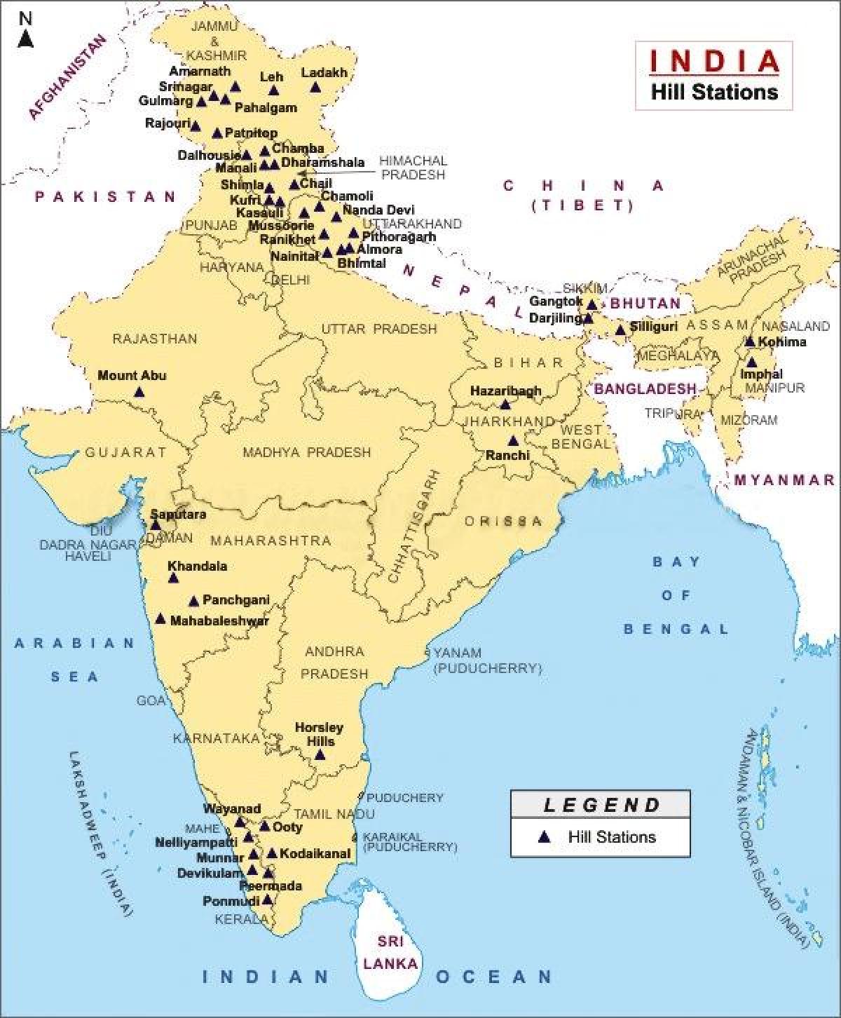
Himadri (Greater Himalayas): It has an average elevation of 6100m includes some of the highest peaks and some of the important passes like Jalep La in the Chumbi Valley in Sikkim and Shipki La in the Sutlej Valley as its shown in India elevation map. Mt. Everest or Sagarmatha, the highest peak of the world, lies in Nepal. Himachal (Lesser Himalaya): It has an average height of 3700-4500 m. The important ranges are Dhauladhar, Pir Panjal, Nag Tibba and Musoorie. Important hill resorts are Shimla, Ranikhet, Almora, Nainital and Darjiiling Valley plains and ‘Doon or Doar’ are special features of this range bordering the outer Himalayas. Shiwaliks (Outer Himalaya): It is recent origin with an average elevation of 900-1200 m, giving a hogback appearance with relatively steeper slope towards the south.
With a height of over 8.5 thousand meters above sea level, the Kanchenjunga peak is the tallest mountain in India a you can see in India elevation map. It borders Nepal and India and has five peaks. This was followed by Nanda Devi at a height of around 7.8 thousand meters. Most of these were present in the northern region of the country and make up a part of the Great Himalayan Ranges.
The rivers in India map shows the principal rivers with their names of India. The rivers map of India will allow you to find the main rivers which flow in and through India in Asia. The India rivers map is downloadable in PDF, printable and free.
Rivers that flow into the sea are sorted geographically, along the coast starting from the Bay of Bengal in the east, moving along the Indian coast southward till Kanyakumari, and moving northward along the Arabian Sea as its shown in India rivers map. Rivers that flow into other rivers are sorted by the proximity of their points of union to the sea: the lower in the list, the more upstream.
The biggest major rivers of India as its mentioned in India rivers map are: flowing into the Bay of Bengal: Brahmaputra, Ganges (with its tributaries Yamuna,Kameika, Gomti, Chambal), Mahanadi, Godavari, Krishna, Kaveri (and their main tributaries), flowing into the Arabian Sea: Indus, Narmada, Tapti (and their main tributaries). The remaining rivers are: flowing into the inner part of India, coastal rivers.
India is famous as the land of rivers as there are numerous rivers flowing across the country. India is the land of rivers and these mighty water bodies play a huge role in the economic development of the country. The rivers in India have been divided into two namely Himalayan Rivers (rivers that originate from the Himalayas) and Peninsular Rivers ( rivers that originate in the Peninsula ) as you can see in India rivers map. Himalayan Rivers are perennial while Peninsular Rivers are rain fed.
The mountains in India map shows the principal mountains with their names in India. The mountains map of India will allow you to find the main mountains ranges and highest mountains of India in Asia. The India mountains map is downloadable in PDF, printable and free.
India mountains are the main tourist attraction. People from outside countries come to pay a visit to these mountains. There are major seven Mountain ranges in India as its shown in India mountains map and those are the Himalaya, Aravalli, Eastern Ghats, Nilgiri, Shivalik, Vindhya, and Satpura mountain ranges. These ranges are covered with dense forests which accommodate a large variety of plants and animals.
The Himalayas as its mentioned in India mountains map are one of the youngest fold mountain ranges in the world of tectonic origin and comprise mainly sedimentary rocks. They stretch from the Indus River in the west to the Brahmaputra River in the east. It consists of three parallel ranges such as Himadri (Greater Himalayas), Himachal (Lesser Himalaya), and Shiwaliks (Outer Himalaya).
The Western Ghat Mountain Range or Sahyadri Range is the India largest mountain range after the Himalayas, which extend from the Tapi river valley to the Nilgiri. It is divided into two parts- the North Sahyadri and the south Sahyadri as you can see in India mountains map. This range is the home of many hill stations like Matheran, Lonavala-Khandala, Mahabaleshwar, Panchgani, Amboli Ghat, Kudremukh and Kodagu.
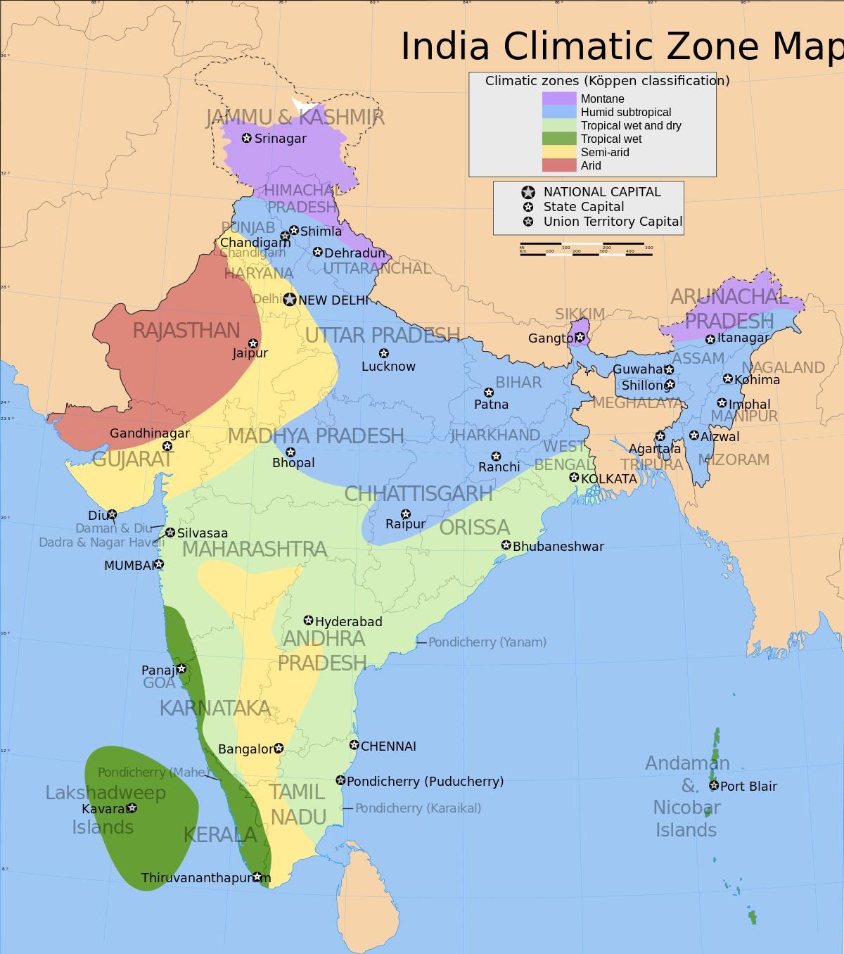
The India climate map shows average temperature and climate zones of India. This climate map of India will allow you to know weather, average precipitation, average sunshine and different climates of India in Asia. The India climate map is downloadable in PDF, printable and free.
Analyzed according to the Köppen system, the climate of India resolves into six major climatic subtypes as its shown in India climate map; their influences give rise to desert in the west, alpine tundra and glaciers in the north, humid tropical regions supporting rain forests in the southwest, and Indian Ocean island territories that flank the Indian subcontinent. Regions have starkly different—yet tightly clustered—microclimates. The nation is largely subject to four seasons: winter (January and February), summer (March to May), a monsoon (rainy) season (June to September), and a post-monsoon period (October to December).
Further climatic changes 20 million years ago, long after India had crashed into the Laurasian landmass, were severe enough to cause the extinction of many endemic Indian forms. The formation of the Himalayas resulted in blockage of frigid Central Asian air, preventing it from reaching India; this made its climate significantly warmer and more tropical in character than it would otherwise have been as its mentioned in India climate map.
A tropical rainy climate governs regions experiencing persistent warm or high temperatures, which normally do not fall below 18 °C (64 °F) as you can see in India climate map. India hosts two climatic subtypes that fall under this group. The most humid is the tropical wet climate—also known as a tropical monsoon climate—that covers a strip of southwestern lowlands abutting the Malabar Coast, the Western Ghats, and southern Assam. India's two island territories, Lakshadweep and the Andaman and Nicobar Islands, are also subject to this climate.


